This coming Tuesday should be the 4th week of school, however, it will be the third due to Hurricane Isaac's appearance. I am looking forward to getting back to work and into the routine of things on Tuesday. I can't wait to hear students tell their stories about their experiences and will definitely have them do a writing describing their experience through Hurricane Isaac to share with all of my followers. Eventually we will post them on Kidblog. So, stay tuned for some wonderful stories!
Everyone here in southern Louisiana is beginning to get power back after 5+ days without electricity, but there are a lot still without power and the temperature here is extremely hot. My parents are one of the many without power and are staying with us at night.
We had very little damage due to the Hurricane unlike many whose homes flooded in southern Louisiana. We lost a few shingles on the roof, our fence is missing a few boards and leaning, and the trampoline and play set has been destroyed. Not too bad for 75+ miles per hour winds.


We will also discuss how Louisiana is the only state in the US with parishes and how it consists of 64 political parishes. Students will also create a foldable showing their street, city, parish, state, country and continent and discuss and record the population of each. Love this foldable I found from Pinterest from Clutter Free Classroom.

Also, love this one from Sunny Days in Second Grade! Love how the students are holding up the world.

Here are a few more Social Studies apps I am planning on students exploring next week.
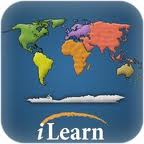
Check this one out for a fun way to learn the names of the continents and oceans!

This app is a great way to get students familiar with the US states.

This app is great to use to help with identifying and describing the features of the US.